7 Astonishing Revelations from the Vinland Map: Evidence of Viking Presence in North America?

The Vinland Map has long fascinated historians and enthusiasts alike. This ancient document is rumored to show Viking voyages to North America centuries before Columbus.
But is it genuine, or a clever forgery? In this article, we’ll explore seven astonishing revelations about the Vinland Map.
We’ll delve into its origins, the debates surrounding its authenticity, and what it might mean for our understanding of Viking exploration.

From its discovery to the latest research, each revelation adds a new layer to this historical mystery. Join us as we uncover the secrets behind this enigmatic map.
What does it really reveal about Viking presence in North America? Let’s dive into the story and find out.
1) Vinland Map
Can you imagine holding a map that could change everything you thought you knew about history? The Vinland Map was that map. Claimed to be a 15th-century document, it was said to prove that Vikings discovered America long before Columbus.
This map first surfaced in 1957 and was soon acquired by Yale University. Though it sparked major excitement and debate, the Vinland Map was eventually revealed as a 20th-century forgery. Modern technology and analysis showed that the ink used was not from medieval times.
Despite this, the saga of the Vinland Map continued. The discovery of a Norse settlement at L'Anse aux Meadows in 1961 fueled the belief in Viking voyages to North America. This settlement provided solid evidence of their presence and adventures in the New World.
The renewed investigations at Yale made it clearer than ever that the Vinland Map was a clever fake. Advanced tools showed the inks were too new. Even so, the map's story remains a captivating chapter in the ongoing intrigue of Viking history and exploration.
2) Norse Sagas
Ever wondered if ancient tales hold any truth?
The Norse sagas are a collection of stories that offer a window into the Viking world. These narratives were passed down orally before being written down in the 13th century. They include the Saga of Erik the Red and the Saga of the Greenlanders.
These stories tell of brave explorers, like Leif Erikson, who ventured to new lands. The Saga of Erik the Red recounts the journey of Leif and his crew to a place they called Vinland, which many believe to be parts of North America.
Remember those cold winters you’ve experienced? Imagine them in the harsh, uncharted territories the Vikings sailed to.
These sagas blend myth, history, and adventure. Scholars still debate the exact locations of events described in these tales. Some even say that L'Anse aux Meadows in Newfoundland might be Vinland.
Imagine sitting by the fire, sharing these exciting adventures with friends and family. That's how these stories survived.
These sagas are more than just tales. They offer valuable insights into Viking culture, exploration, and their interaction with new lands.
3) "Vinland" - Eirik the Red's Saga
In "Eirik the Red's Saga," Vinland marks a significant chapter for the Norse explorers. Eirik the Red, a fierce and adventurous figure, was instrumental in these early explorations. The saga tells that Eirik, after naming Greenland, set out to recruit settlers and his family played a big role in further discoveries.
Leif Eriksson, Eirik's son, took the quest further. Around the year 1000, Leif ventured westward from Greenland. His expedition led to the discovery of Vinland, named for its abundant wild grapes and fertile land. This new territory represented a land full of resources, which was a dream for the Norse.
Vinland wasn't just a land of myths; it was grounded in real sagas. Eirik the Red's Saga provides not only a captivating story but also valuable historical insights. The saga notes the interactions with Indigenous people, known as the Skraelings. These meetings were sometimes peaceful, other times tense.
The details in the saga paint a vivid image of Norse life. Descriptions of voyages, settlements, and everyday struggles make history come alive. It offers a unique window into the past, blending storytelling with actual events, illustrating the bravery and resilience of these explorers.
4) Viking Longships
Think of Viking longships as the sports cars of the medieval seas. Sleek, fast, and incredibly versatile. Can you imagine gliding over the waves in one of those?
Longships were designed to be lightweight and flexible. They had shallow drafts, which means they could navigate both deep ocean waters and shallow rivers. This was key for their explorations and raids.
Picture this: a crew of around 60 men, rowing in unison, moving swiftly and silently. These ships could cover vast distances without needing large ports, practically beaching anywhere they pleased.
The craft of building longships was an art. Viking shipbuilders used overlapping planks, or "clinker-built" design. This made the ships strong yet flexible, perfect for the rough North Atlantic waters. They could even survive storms that would wreck other vessels.
These ships were more than just tools for war. They represented the Norse spirit of exploration. With them, the Vikings reached places like Greenland and Newfoundland.
5) Eric the Red's Greenland Settlement

Imagine standing on the shores of a new, uncharted land. That's what Eric the Red experienced when he settled Greenland in 985 CE.
Can you picture the excitement? He sailed from Iceland with 25 ships. Surprisingly, only 14 made it. Upon arrival, they founded two main settlements: the Eastern and Western Settlements.
Why Greenland? Eric had a vision. After being exiled from Norway and Iceland for his fiery temper and conflicts, he ventured westward.
He named the land "Greenland" to attract other settlers, thinking the name would make it sound more appealing. Quite clever, right?
The settlers chose coastal areas. These spots offered the best chances for survival. They could fish, hunt, and eventually farm. Ice and tough weather didn’t make life easy. But the Vikings, with their resilience, made it work.
Eric the Red's legacy in Greenland wasn't just about survival. His son, Leif Erikson, later used Greenland as a stepping stone to explore further west. This opened the door to even more discoveries.
6) Icelandic Annals

The Icelandic Annals are key historical records that provide insight into Viking exploration. These annals were written in medieval Iceland. They contain valuable information about events in Europe and the North Atlantic.
Can you picture it? The annals document tales of brave sailors venturing into the unknown. They highlight voyages to Greenland and Vinland, offering a peek into the Viking world.
You come across mentions of Icelandic settlers braving harsh seas. Their journeys expand beyond Iceland, reaching places like Vinland. These entries make you wonder: what drove them to explore such vast distances?
The Icelandic Annals also record interactions with Indigenous peoples. They note encounters that Vikings had in these mysterious lands. It's fascinating to see these early records of cross-cultural connections.
Important dates are often linked to the reigns of kings or climatic events. For example, you may find entries tied to volcanic eruptions or famines. These details help frame the timeline of these explorers' adventures.
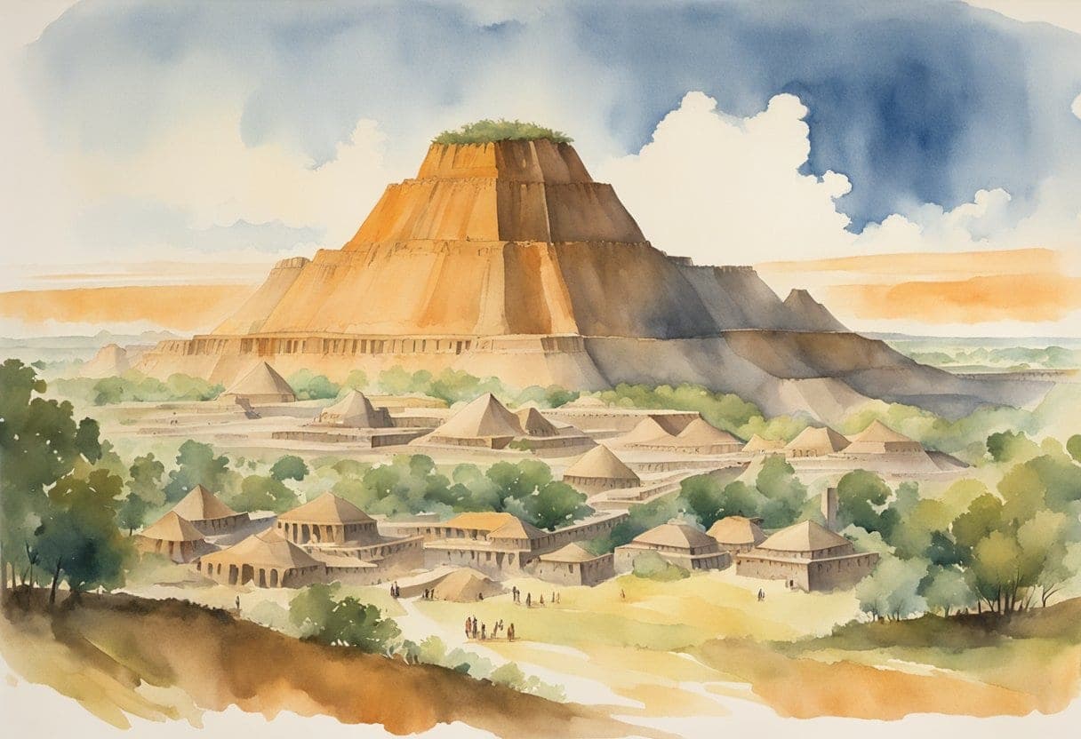
7) Pre-Columbian Norse Settlements

Imagine standing on the northern coast of Newfoundland. Can you smell the salty air? This is where the Viking settlement of L'Anse aux Meadows existed around 1000 AD.
L'Anse aux Meadows is a key archaeological site. The structures found there match descriptions from the Norse sagas, such as the Greenlanders' Saga and Eirik the Red's Saga.
Norse explorers, led by Leif Erikson, built this small settlement. They called the land "Vinland," believed to be named for the wild grapes found there.
The site includes eight buildings. These were likely used for housing, workshops, and storage. Many artifacts have been discovered, including iron nails and a spindle whorl, showing that the Norse were skilled craftsmen.
Interestingly, L'Anse aux Meadows is the only confirmed Norse site in North America. There may have been other settlements, as suggested by different sagas, but none have been found yet.
To learn more about this site, you can explore the account of Norse house-sites.
Viking Exploration of North America

The Vikings were some of the earliest Europeans to explore North America. They established settlements and left behind archaeological evidence that continues to intrigue historians.
Key Expeditions and Settlements
Norse exploration of North America began in the late 10th century. Norsemen journeyed across the North Atlantic, first reaching Greenland.
The most famous site, L'Anse aux Meadows, is located at the northern tip of Newfoundland.
Leif Erikson, the son of Erik the Red, is often credited with leading these early voyages. Around the year 1000, his expedition discovered a land he called "Vinland," known for its wild grapes. This land hosted the first known European settlement in North America.
Archaeological Evidence
The discovery of L'Anse aux Meadows in 1960 was a breakthrough. Excavations revealed the remains of eight buildings, including workshops and living quarters.
Artifacts such as nails, woodworking, and metal tools, confirmed Viking presence and activities.
Tree-ring analysis provided a precise timeline, dating the site to 1021 C.E.
This method showed that Vikings used local timber for construction.
Conclusion
The Vinland Map remains a tantalizing mystery in the realm of historical research. While some evidence points to its authenticity, significant doubts and debates continue to cloud its true origins.
Its potential to alter our understanding of Viking exploration is both thrilling and controversial. Scholars and enthusiasts alike grapple with the implications of this map.
As we uncover more evidence, the question of its legitimacy remains unsettled. The map's allure lies in its ability to spark curiosity and debate.
Whether a genuine artifact or a clever forgery, it has undeniably left its mark on history. Continued research and analysis will be crucial in resolving the map’s mysteries.
Until then, the Vinland Map continues to be a symbol of historical intrigue. Its story is far from over, inviting further exploration and discovery.
Ready to restore your own photos?
Our artists bring your damaged photos back by hand, most within a few days.
Rated 4.96 out of 5 stars.4.96/5 · Loved by 400,000+ families